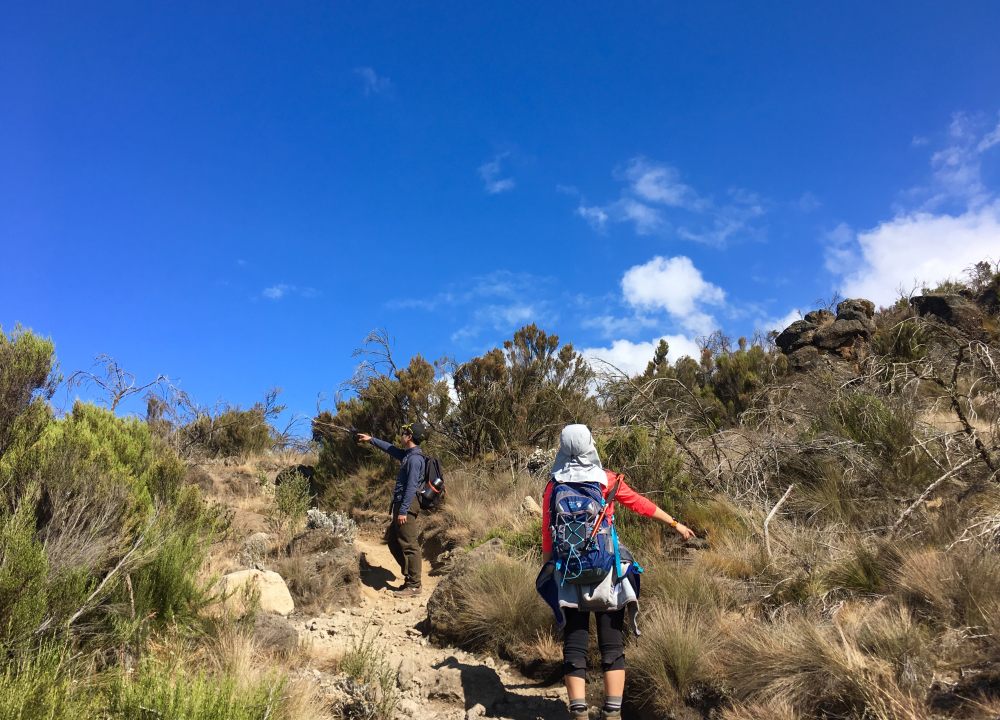
乞力马扎罗(Kilimanjaro)——非洲之巅,作家海明威赋予它不朽的灵魂。它是全世界登山爱好者向往的地方,也是最容易完成的七大洲高峰攀登路线。乞力马扎罗山是坦桑尼亚和肯尼亚的分水岭,龙盖线是唯一一条从北部穿越乞力马扎罗山的路线,这条线路保留了最原始的未被破坏的自然风景,为攀登者展现出一道与众不同的自然风光;并且这条路线的难度比威士忌线略低,属于休闲型路线,即使是没有太多徒步经验的人也可以尝试。
产品经理说:乞力马扎罗的登山线路一般市面上只有可口可乐和威士忌线路,缺点都是过于商业化,人满为患,原本行程是根据欧洲人的需求进行设计的,无论是餐饮、身体能力、体验度……中国客人在参加传统的攀登过程中感到不是特别适应。所以我们考虑到中国人的体能特点及体验需求,重点推荐龙盖线这条集安全、体验、风景一体的乞力马扎罗登山线路最佳方案,还提供其他几条登山线路方案。在确保满足所有人的登山需求的同时,我们升级了般马特色服务标准,力图让每一位客人都能享受到登山的快乐与成就感。


Arrive at Kilimanjaro international airport meet and great by our representative transfer to Kibo Palace Hotel for the overnight booked on bed and breakfast
Accommodation : Kibo Palace Hotel (or similar)
Meal : (On Own); Supper (Welcome Dinner)


- Reference Hotel Pictures
Kibo Palace Hotel酒店以非洲最高峰乞力马扎罗山的最高峰命名,是阿鲁沙最令人兴奋和最具创新性的豪华酒店之一。现代、导电、不落俗套,以崭新姿态打造豪华酒店。酒店地理位置优越,距离乞力马扎罗机场 45 分钟车程,步行 10 分钟即可到达中央商务区。银行和医院设施都在酒店半径50米以内。


Hiking time: 4 hoursDistance: Approximately 6.7 kmHabitat: Forest (Montane)
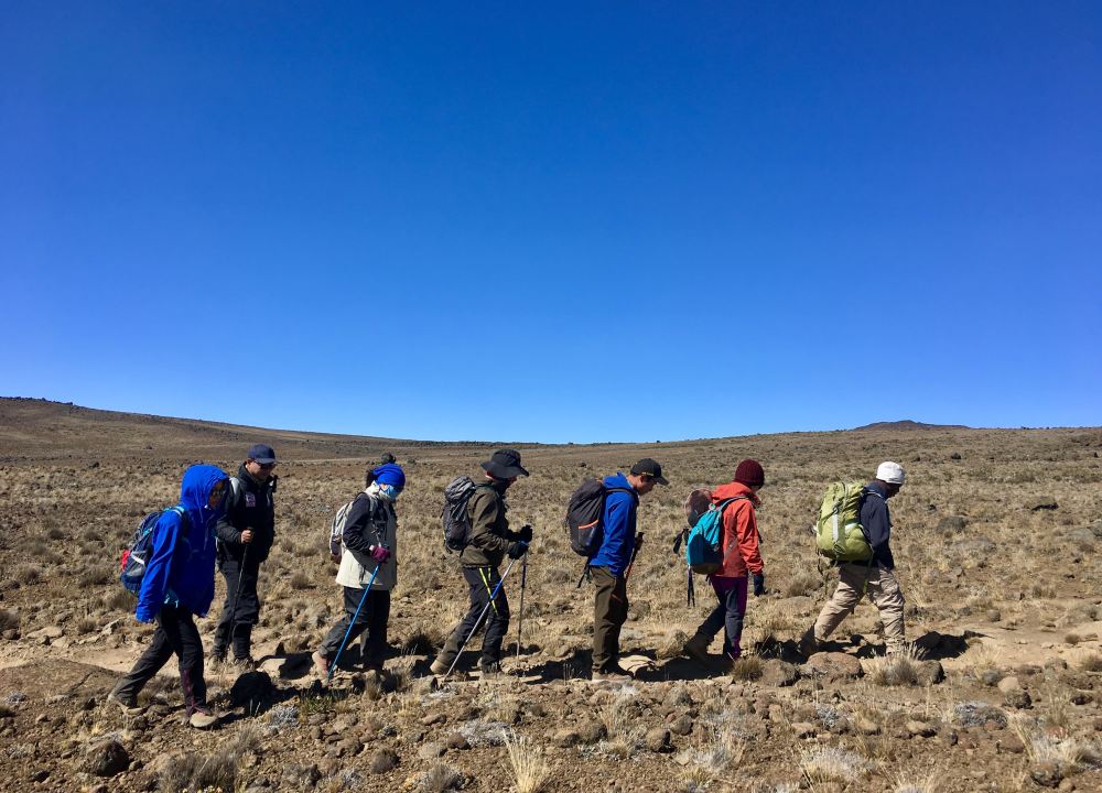
Depart from Moshi town and drive 45 Minutes to the Marangu park gate for registration. From Marangu park gate we travel to Naro Moru, north east Kilimanjaro, a further 68km and approximately 2 ½ hours on bad roads to the Rongai start point (1996m). Meet your guide and porters before you begin your hike from the Nale Moru village. The small winding path crosses maize fields before entering pine forest, and then climbs gently through a forest. The trail is not at all steep, but is rather a gentle hike through a beautiful country side. The first night’s camp is at Simba Camp (2 626m). The camp facilities include a public toilet and a wooden table with benches, but no hut.
Accommodation : Simba CampTent in Camping site
Meal : Breakfast; Lunch (Picnic); Supper (Camp Meal)
Trekking Distance : 7 kilometers
Trekking Time : 4-5 hours
Altitude Gains & Losses : +850 meters
Highest Altitude : 2626 meters

Distance: Approximately 11.8 kmHabitat: Moorlands
We hike from Simba camp up towards Kibo till 3 482m for lunch at First Caves, a distance of 5.8km. After lunch we continue trekking until reaching Kikelewa Camp at about 3679 metres. The views start to open up and you begin to feel you’re on a really big mountain! Water can be found in a obvious stream below the cave, although you might have to wander downhill a way to find a pool or two. Enjoy dinner and overnight at Kikelewa camp.
Accommodation : Kikelewa CampTent in Camping site
Meal : Breakfast; Lunch (Picnic); Supper (Camp Meal)
Trekking Distance : 12 kilometers
Trekking Time : 6-7 hours
Altitude Gains & Losses : +950 meters
Highest Altitude : 3679 meters

Distance: Approximately 3.7 kmHabitat: Moorlands
A short but steep climb up grassy slopes offers superb views of this wilderness area. The vegetation zone ends shortly before you reach your next camp at Mawenzi Tarn spectacularly situated beneath the towering spires of Mawenzi. Spend the afternoon acclimatizing and exploring the area.
Accommodation : Mawenzi Tarn CampTent in Camping site
Meal : Breakfast; Lunch (Picnic); Supper (Camp Meal)
Trekking Distance : 4 kilometers
Trekking Time : 3-4 hours
Altitude Gains & Losses : +720 meters
Highest Altitude : 4300 meters

Distance: Approximately 9 kmHabitat: Alpine desert
After breakfast we head west and continue ascending on the east side of Kibo crossing the saddle between Mawenzi and Kibo taking 4 to 5 hours to reach Kibo Hut. The remainder of the day is spent resting in preparation for the final ascent, which begins around midnight. Overnight at Kibo hut.
Accommodation : Kibo CampTent in Camping site
Meal : Breakfast; Lunch (Picnic); Supper (Camp Meal)
Trekking Distance : 9 kilometers
Trekking Time : 5-6 hours
Altitude Gains & Losses : +380 meters
Highest Altitude : 4730 meters

Hiking time: 7 to 8 hours to reach Uhuru Peak, 6 to 8 hours to descend to Horombo
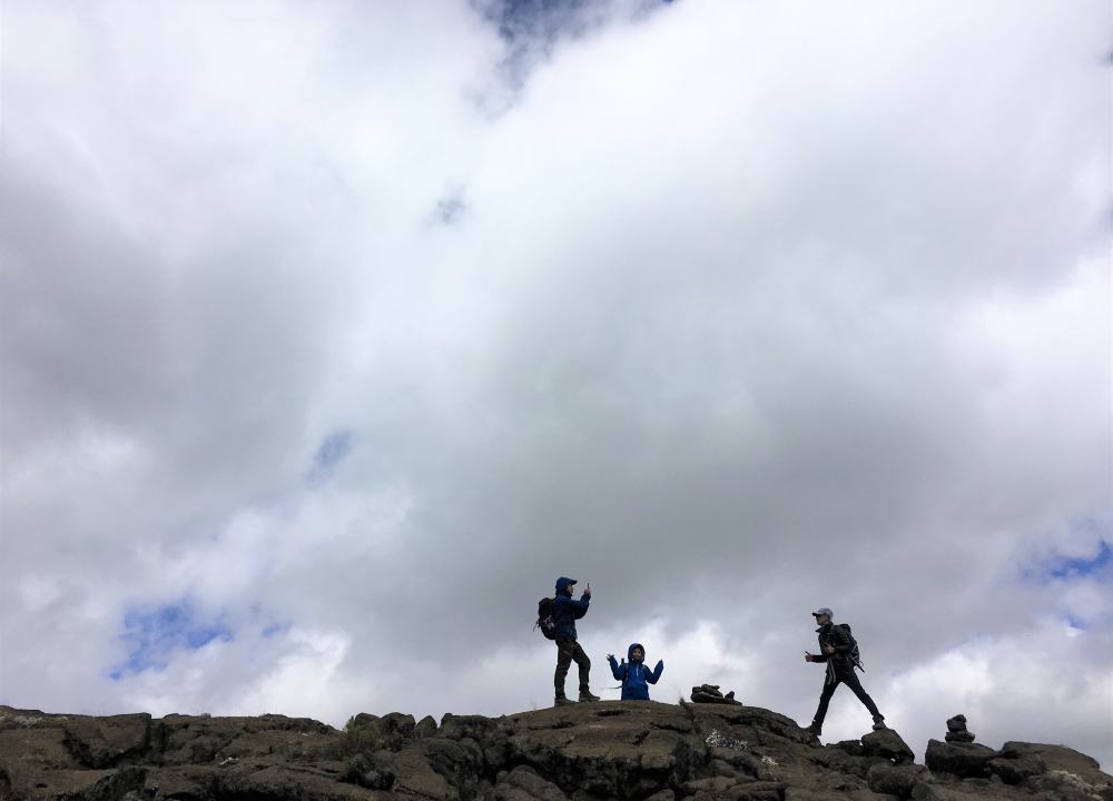
Distance: Approximately 5.4km ascent and 15 km descentHabitat: Stone scree / ice-cap summit You will rise around 23h20, and after some tea and biscuits you shuffle off into the night, and this is where the going really gets tough. The first section of the trail consists of a rocky path to the Hans Meyer Cave (5150m), also a good resting spot. The path then zigzags up to Gillman’s point (5 681m), which is located on the crater rim. This section is very steep with a lot of stone scree, requiring a great physical and mental effort. This is probably the most demanding section of the entire route. Do the Kili shuffle and move slowly. From Gillmans Point you will normally encounter snow all the way up to Uhuru peak (5895m), the highest point in Africa.
Total exhilaration and satisfaction – you made it Weather conditions on the summit will determine how long you will be able to spend, taking photographs, before the 3 hour descent back to Kibo hut. After a short rest at Kibo hot, you gather all your gear you left behind for the ascent and head down to Horombo hut (3 hours) for your overnight. The return to Horombo hut will seem surprisingly fast compared to the ascent. The total time spent walking on this day is around 14 hours, so be prepared for a very tough day. Later in the evening you enjoy your last dinner (with soft drinks and beer for sale at the camp office) on the mountain and a well-earned sleep, filled with memories and stirring emotions.
Accommodation : Horombo CampTent in Camping site
Meal : Breakfast; Lunch (Picnic); Supper (Camp Meal)
Trekking Distance : 22 kilometers
Trekking Time : more than 8 hours
Altitude Gains & Losses : +1300/-1600 meters
Highest Altitude : 5895 meters


Hiking time: 6 hoursDistance: Approximately 19.7 kmHabitat: Moorland & Montane Forest After breakfast you continue your descent (6 hours), passing the Mandara hut, down to the Marangu gate. It is strongly recommended not to pay your porters any tips until you and all your gear have reached the gate safely. Click here for more info on tips. At Marangu gate you sign your name and details in a register. This is also where successful climbers receive their summit certificates. Those climbers who reached Gillman’s Point (5685m) are issued with green certificates and those who reached Uhuru Peak (5895m), receive gold certificates.
You now drive back to Arusha for a long overdue hot shower, dinner descent bed and celebrations!!
Accommodation: Kibo Palace Hotel for the overnight booked on booked on bed and breakfast
Accommodation : Kibo Palace Hotel (or similar)
Meal : Breakfast; Lunch (Picnic)
Trekking Distance : 19 kilometers
Trekking Time : 6-7 hours
Altitude Gains & Losses : -1800 meters
Highest Altitude : 3705 meters


- Reference Hotel Pictures
Kibo Palace Hotel酒店以非洲最高峰乞力马扎罗山的最高峰命名,是阿鲁沙最令人兴奋和最具创新性的豪华酒店之一。现代、导电、不落俗套,以崭新姿态打造豪华酒店。酒店地理位置优越,距离乞力马扎罗机场 45 分钟车程,步行 10 分钟即可到达中央商务区。银行和医院设施都在酒店半径50米以内。
Day 08: Transfer airport for your flight back home
Accommodation : Own arrangement
Meal : Breakfast


Route Type 登山
Route CodeKILRON
Follow our subscription account to stay informed about the latest Pama information and the most unique outdoor travel routes around the world.

For online consultation, route consultation, event customization, and business cooperation, please add Xiaoma WeChat.