DAY 1: ARRIVAL TO KEFLAVIK. TRANSFER TO REYKJAVIK
Arrival at Keflavik. Meet our guide and our private van in the airport. Drive crossing the
northern area of the Reykjanes peninsula, will take us to the capital (45 km). After check-in in
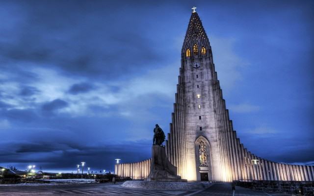
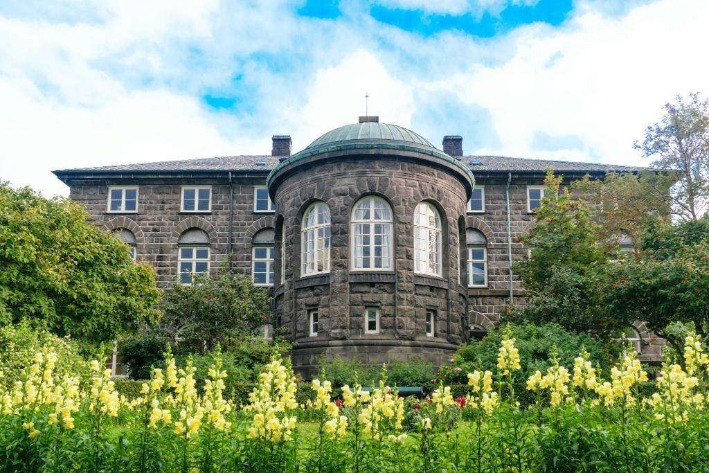
our hotel we will have free time to exploreReykjavik: take your time to visit the Harpa building,
the Tjörnin Lake, the Austuvollur Square, theSolfar monument and climb the 73 metres tall
tower of modernist church of Hallgrímskirkja to enjoy the best views in town. Accommodation
in hotel
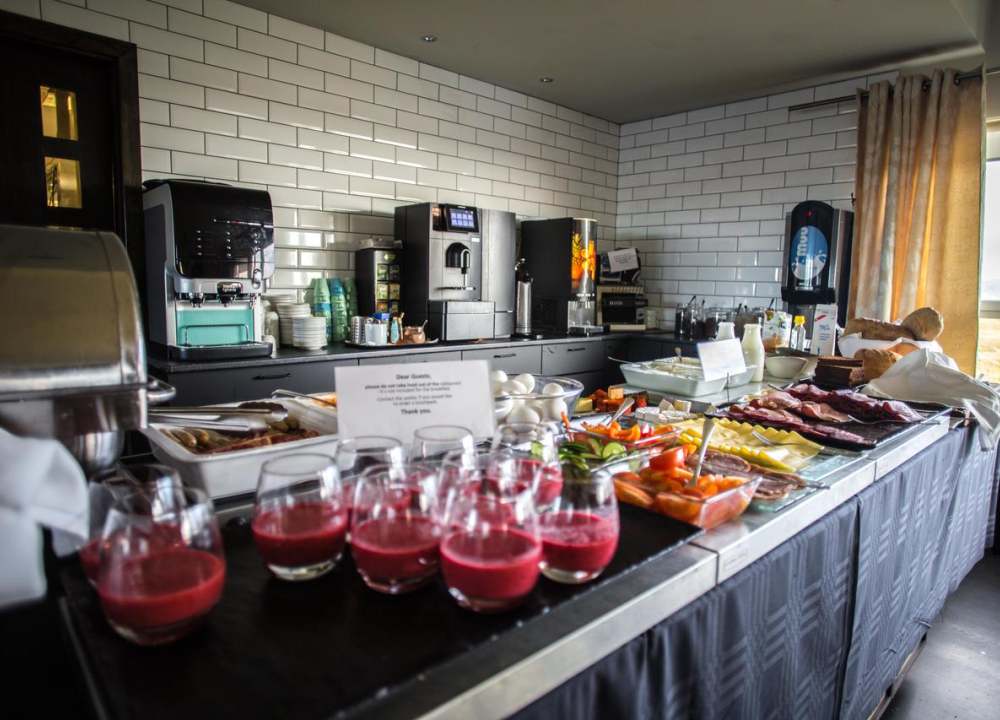
Accommodation : (or similar)

- Reference Hotel Pictures

Explore classics today as we travel the route of the Golden Circle sights. Start the day visiting
the ancient Viking Parliament area and UNESCO world heritage site of Þingvellir National Park.
The Þingvellir plain is situated on a tectonic-plate boundary where North America and Europe
are slowly tearing away from each other. As a result, the plain is scarred by dramatic fissures,
ponds, and rivers, including the great rift Almannagjá. Later on we will walk through the active
geothermal area of Geysir, where Strokkur “the churn” spouts up to 25 meters every five to ten
minutes. Continue to Gullfoss, “the golden falls“, which is a double waterfall that tumbles 34
meters into the Hvítá river and attracts travellers in summer and winter. In the afternoon we
will start driving the route leads over the interior highland areas, the Kjölur Route, a broad rocky
lava covered pass between the giant icefields, Hofsjökull and Langjökull. On a fine day, Kjöllur
is an unforgettable drive of breathtaking beauty. The route travelled is an ancient north and
south horse trail artery. Along the uninhabited highland route there are extensive views of
mountains of all sizes and shapes, the two ice fields Langjökull and Hofsjökull, a black desert
and towards Kerlingarfjöll a colourful range of rhyloite mountains. This is a true mountain
wilderness of spectacular peaks, canyons and hidden here are strange and colorful thermal
areas. In the food of Kerlingarföll area we will set up our campsite near the nature hot springs.
Bath and relax. Night in tents
Kerlingarföll
Tents in the campsite near the Visitor Center. Free access to kitchen facilities and toilets (WC).
Breakfast served in the restaurant of the main building.
Accommodation : (or similar)
Meal : Breakfast; Supper (Camp Meal)


- Reference Hotel Pictures


DAY 3: KERLINGARFÖLL HIKE - SELFOSS
Full day to hike and explore one of the most stunning spots in the Highland. Start the hike from
the Visitors Center to Hveradalir valley “The Fumaroles valley”. Here we will discover a rich
geothermal systemof hot water streams, fumaroles, small geysers and bubbling mud
pots,surrounged by multicolored peaks and alpine glaciers. If the weather and the mountain
conditions are good, we will hike up one of the peaks of the area to get best views over
Kerlingarföll. Return Visitor Center descending along the trail near Argardur gorge. Hiking
route: 12-15 km (5-6 h). In the afternoon drive 2 hours the Kjölur route back to Gulfoss and 1
h more to reach Selfoss. Night in appartments.
Kerlingarföll Hotel (Alda Building)
Only possible as upgrade if available, please book at least 3 months in advance, see
supplements for prices.
https://www.kerlingarfjoll.is/staying-at-kf
Breakfast served in the restaurant of the main building.
Accommodation : (or similar)
Meal : Breakfast
Trekking Distance : 12 kilometers
Trekking Time : 5-6 hours


- Reference Hotel Pictures


DAY 4: SELFOSS - LANDMANNALAUGAR HIKE - SELFOSS
Early in the morning drive 140km (2h30) to Landmannalaugar. This is one of the most scenic
areas in the interior highlands of Iceland, perhaps the most colourful and diversified of the
many interesting mountain tracks, rugged colourful landscape of unsurpassed beauty. Time to
enjoy a circular walk crossing different valleys and climbing up 3 panoramic summits. In
Námsrhaun (10 minutes walking from Landmannalaugar visitor center) start climbing the
Suðurnámur ridge until the highest point (914 km). After descending to the bottom of the
gorge, start the hike up to the second summit, the coulourfull summit of Brennisteinsalda (886
m). Pass throght the fumaroles field of Brennisteinsalda valley and descent to Graenagil gorge.
This is the starting point of the ascent of our last summit, Bláhnúkur (943 m). 360º panorama
from the top. Descent the north ridge until arrive directly to Landmannalaugar visitors center.
Distance: 13km, Altitude gain: +/-950 m, Time: 5h
In the afternoon, after the hike start the drive to Selfoss (2h30). Night in appartments.
Accommodation : (or similar)
Meal : Breakfast
Trekking Distance : 13 kilometers
Trekking Time : 4-5 hours
Altitude Gains & Losses : +950/-950 meters


- Reference Hotel Pictures
DAY 5: SELFOSS – 20 WATERFALLS HIKING – VIK - KIRKJUBAEJARKLAUSTUR
After breakfast we will move to Skógar. This is the finnish point of the famous Laugavegur Trail,
connecting the Highlands (Landmannalaugar) with the coast (Skógar). During the morning we
have planned a hike following the Laugavegur Trail in direction to Fimmvörðuháls, a mountain
pass between the Eyjafjallajökull and Myrdalsjökull volcanoes. The trail starts close to the
beautiful Skógafoss waterfall and ascent all the left side of the river. In this section of the river
the water flows through a deep canyon with deep green walls and cutted by at least 20
waterfalls. After 5,5 km we will arrive to a bridge over the gorge, this will be the return point.
Descend the same way to Skógar. Distance: 11 km, Altitude gain: +/- 300 m, Time: 4 h.Free time
to lunch. During the afternoon in the way to our accommodation we will make some short
photo stops: Dyrholaey cliffs to see the puffin colony (only from May to middle August) and
Reynisfjara black beach/basalt cliffs. Night in hotel in Kirkjubaejarklaustur.
Kirkjubaejarklaustur
Hotel Laki or similar
http://www.hotellaki.is/
Double/twin rooms with private bathroom.
Breakfast included served in the hotel restaurant.
Accommodation : (or similar)
Meal : Breakfast
Trekking Distance : 11 kilometers
Trekking Time : 3-4 hours
Altitude Gains & Losses : +300/-300 meters


- Reference Hotel Pictures

DAY 6. KIRKJUBAEJARKLAUSTUR–SKAFTAFELL NATIONAL PARK (VATNAJÖKULL) –
JOKULSARLON - KIRKJUBAEJARKLAUSTUR
Continue west along the south coast and head for the Skaftafell National Park (70 km, 1 h
driving from our hotel). In June 2008, Skaftafell National Park was integrated with the
Vatnajökull National Park which covers a 13.000 km² terrain, close to 13% of Iceland´s land
mass. To this day it ranks as Europe’s largest National Park. Skaftafell’snatural beauty is
sensational and offers a unique view both of Iceland highest peak, Hvannadalshnjúkur (2.110
m), and the country’s largest glacier valley. Here we will participate in one of the most
rewarding adventures that we can experience in Iceland, an Ice Trek over Skaftafell glacier.
From the parking lot there it is only a 15 minutewalk to the edge of the ice where your guide
will show you how to put on the crampons, steel frames which are tied to your hiking boots
and make it possible for you to walk on the glacier.The glacier outlets of Vatnajökull and their
spectacular landscapes have been scenery for dozens of movies and TV shows such as James
Bond, Interstellar, Batman, and Game of Thrones.After the Ice Trek and before leaving
Skaftafell National Park we can take an easy and short walk to Svártifoss waterfall, “The Black
Fall”(3 km, 1h30 roundtrip), surrounded by black basalt columnar formations. After
Skaftafellcontinue driving to the east and head for Jökulsárlón, the Glacial Lagoon, one the
most popular tourist attraction in Iceland. Huge icebergs, true sculptures of nature floating on
the blue glacial waters at the foot of the Breiðamerkurjökull glacier, where seals are often to
be seen. Finish the day taking the best photos to the ice blocks stranded along the Diamond
Beach. In the evening return to Klaustur. Night in hotel.
Accommodation : (or similar)
Meal : Breakfast
Trekking Distance : 5 kilometers
Trekking Time : 1-2 hours


- Reference Hotel Pictures
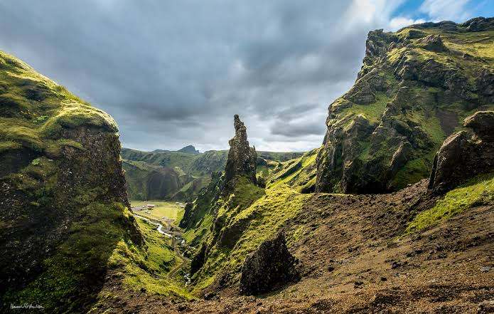
DAY 7: KLAUSTUR – ÞAKGIL – REYKJAVIK
After breakfast drive 85 km to Þakgil campsite. Hike one of the most beautiful gorges in
southern Iceland (Game of Thrones, parts of which were filmed here) thatwill lead us
toHuldufoss, a waterfall fed by the melting of Myrdalsjökull glacier. During the hike we’ll
explore caves, canyons, magical rocks formation and beautiful landscapes that covers from sea
to glacier. Distance: 17 km, Altitude gain: +/- 700 m, Time: 5-6 h. In the afternoon drive to
Reykjavik (3h), stopping in the way to visit the famous Seljalandfoss waterfall. Night in hotel
Accommodation : (or similar)
Meal : Breakfast
Trekking Distance : 6 kilometers
Trekking Time : 2-3 hours
Altitude Gains & Losses : +700/-700 meters

- Reference Hotel Pictures
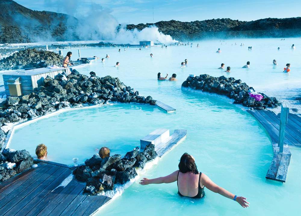
After breakfaststart driving to Keflavik Airport. In the way, if we have enough time, we can
enjoy a relaxing bath in Blue Lagoon, the most famous thermal and spa complex in Iceland.
Accommodation : Own arrangement
Meal : Breakfast

Route Type Trekking
Route CodeISTRK1
Follow our subscription account to stay informed about the latest Pama information and the most unique outdoor travel routes around the world.

For online consultation, route consultation, event customization, and business cooperation, please add Xiaoma WeChat.